Persistent Ground Truth
for Distribution Infrastructure
VisionMesh provides end-to-end ground-truth data for electric distribution infrastructure. We convert street-level imagery into structured, evidence-backed field observations that are image-linked, timestamped, and traceable; supporting defensible validation of asset records and condition.
Asset record divergence
Field conditions drift from system records over time, leaving planners and engineers working from assumptions.
Reactive maintenance risk
Unseen equipment health issues surface as emergent repairs instead of planned capital work, increasing cost and disruption.
Audit & traceability confidence
Without repeatable, evidence-backed validation, defensibility erodes for regulatory reporting, FEMA submissions, and audits.
Request coverage. VisionMesh delivers the dataset.
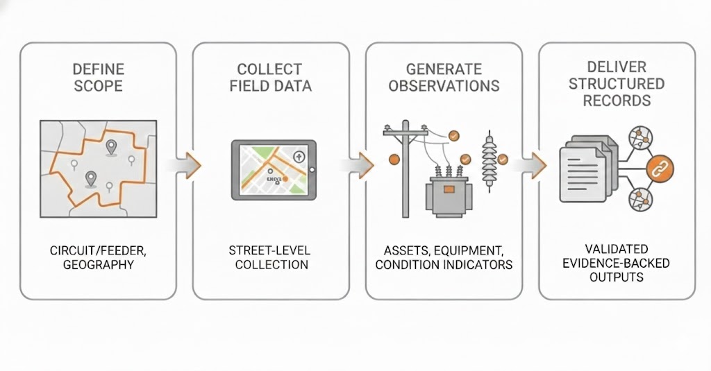
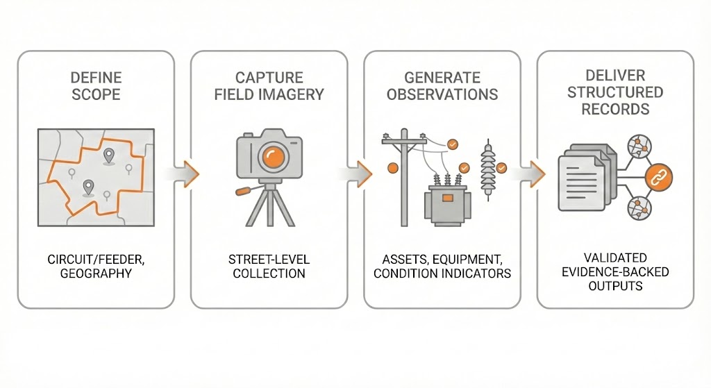
Utilities specify a circuit, feeder, geography, or operating area. VisionMesh handles the full process- from field capture through delivery of a curated, review-ready dataset with direct evidence links.
- Define scope - circuit/feeder, boundary, or region
- Capture field imagery - street-level evidence collection
- Generate observations - assets, equipment, and condition indicators
- Deliver structured records - evidence-linked outputs for validation and reconciliation
No operational integration. No system write-backs. Outputs are designed for human review, planning, and audit workflows.
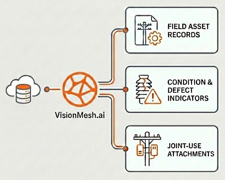
What VisionMesh delivers
VisionMesh delivers a structured dataset representing observed field reality:
- A complete inventory of visible distribution assets and associated equipment
- Approximate geolocation suitable for GIS reconciliation and delta comparison
- Image-backed records for every asset, with a traceable audit trail
- Categorized condition indicators to support maintenance and capital planning
- Observed joint-use attachments and wiring configuration for lease review
Now accepting pilot applications
VisionMesh pilots evaluate data credibility, coverage, and planning value using real field evidence without operational risk. Pilots typically focus on a defined feeder, circuit, or geographic area and are delivered as a complete, evidence-backed dataset.