Solutions
Evidence-backed field data for utility decision making.
Asset Identification for GIS Reconciliation
Verified inventory of visible distribution assets based on observed field reality. Enables GIS reconciliation and delta comparison workflows by providing image-backed evidence and location context that utilities can use to validate records, surface discrepancies, and prioritize follow-up.
- Image-backed identification of poles, crossarms, transformers, and related equipment
- Approximate geolocation suitable for GIS delta comparison
- Enables validation of assets observed in the field against system records (e.g., assets present in-field but missing in GIS)
- Enables review of system-recorded assets without recent field evidence (for follow-up validation)
Supports evidence-based GIS reconciliation and improves confidence in downstream planning, accounting, and audit processes without requiring survey-grade precision.
Condition & Defect Observations for Planning
Identifies visible condition indicators across distribution assets to support planning decisions. VisionMesh does not prescribe actions or issue work orders; it provides structured, categorized observations.
- Structural orientation thresholds (e.g., pole lean, crossarm tilt)
- External damage indicators (e.g., corrosion, fire damage)
- Hardware integrity issues (e.g., displaced insulators, missing or unseated equipment)
- Evidence-backed condition records suitable for engineering review
Supports a shift from emergent repairs to planned maintenance by making condition signals visible, reviewable, and comparable over time.

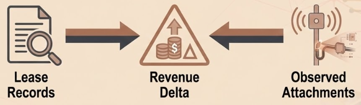
Joint-Use & Telecom Attachment Visibility
Provides visibility into joint-use attachments observed in the field and supports comparison against lease or billing records. Identifies and categorizes observed attachments with image-backed evidence.
- Identification of poles with observed telecom vs electrical attachments
- Image-backed evidence for attachment presence and configuration
- Structured outputs suitable for audit, review, and revenue analysis
Enables non-disruptive inventory accuracy and revenue assurance workflows using defensible field evidence.
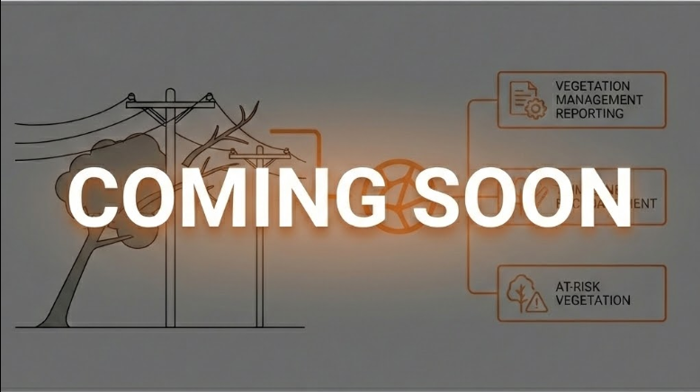
Vegetation Management Observations
VisionMesh is developing vegetation-related capabilities designed to support vegetation management planning and prioritization. This program will focus on repeatable, evidence-backed visibility of vegetation proximity and change over time to strengthen seasonal planning and risk awareness.
- Vegetation proximity indicators near overhead distribution assets
- Repeatable observations for seasonal and event-based comparison
- Evidence-linked outputs suitable for planning and review workflows